The Atlas Mountains stretch across North Africa like a vast backbone, shaping landscapes, climates, and cultures across Morocco, Algeria, and Tunisia. Understanding this rugged system becomes much easier with an atlas mountains map.
This helps travelers, geographers, and adventure seekers visualize its complex ranges, high peaks, and historic mountain passes. This guide explores the major regions, notable summits, and key routes that define this iconic mountain chain.
Overview of the Atlas Mountain System
The Atlas Mountains are not a single continuous ridge but a series of connected ranges. These include the High Atlas, Middle Atlas, Anti-Atlas, Tell Atlas, and Saharan Atlas. Each subrange has distinct geological features and elevations.
The High Atlas in Morocco contains the highest peaks in North Africa, while the Tell Atlas in Algeria runs closer to the Mediterranean coast. A well-detailed atlas mountains map reveals how these ranges form a natural barrier between the Atlantic and Mediterranean climates in the north and the Sahara Desert in the south.
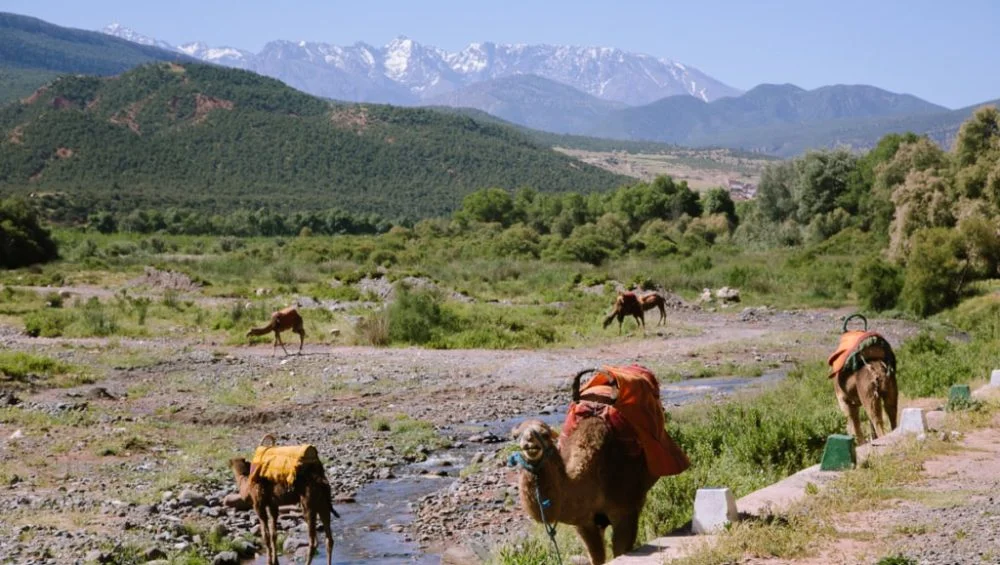
High Atlas: The Roof of North Africa
The High Atlas is the most famous and dramatic section of the mountain system. It is home to rugged peaks, deep valleys, and traditional Berber villages.
The highest peak in the entire range is Mount Toubkal, standing at 4,167 meters (13,671 feet). Located near Marrakech, it attracts hikers and climbers from around the world. Other important peaks include Ouanoukrim, Ighil M’Goun, and Timesguida.
When studying the region using an atlas mountains map, you can clearly see how the High Atlas runs diagonally across central Morocco, forming a striking natural spine. This region is also known for its seasonal snow, making it one of the few places in Africa suitable for winter trekking.
Middle Atlas: Forested Highlands and Lakes
North of the High Atlas lies the Middle Atlas, a greener and more temperate region. It is characterized by cedar forests, volcanic plateaus, and freshwater lakes.
Unlike the rugged High Atlas, the Middle Atlas features rolling hills and more accessible terrain. Cities like Ifrane, often called “Little Switzerland,” are located here due to their European-style architecture and cool climate.
On an atlas mountains map, this region appears as a softer, more rounded extension of the main mountain system, connecting the High Atlas to the Rif Mountains further north. It is also home to diverse wildlife, including the endangered Barbary macaque.
Anti-Atlas: Ancient and Arid Landscapes
The Anti-Atlas lies to the south of the High Atlas and is one of the oldest geological formations in the region. It is more arid and rocky, with dramatic desert-like scenery.
This area is less populated and features traditional Amazigh settlements, fortified villages, and prehistoric rock formations. The peaks here are generally lower, but the landscape is equally impressive due to its stark beauty.
Using an atlas mountains, the Anti-Atlas appears as a southern arc running parallel to the High Atlas, gradually blending into the edges of the Sahara Desert. It is a popular destination for travelers seeking remote trekking experiences.
Major Mountain Passes
Mountain passes in the Atlas region have historically been crucial for trade, migration, and cultural exchange. Even today, they remain vital transportation routes.
Tizi n’Tichka Pass
One of the most important passes is Tizi n’Tichka, which connects Marrakech to Ouarzazate. At over 2,200 meters in elevation, it offers breathtaking views of winding roads and dramatic cliffs. A detailed atlas mountains map shows this pass as a key crossing through the High Atlas.
Tizi n’Test Pass
Another historic route is Tizi n’Test, which links Marrakech to Taroudant. This older road passes through remote Berber villages and offers a quieter alternative to Tizi n’Tichka.
Tizi n’Tilghmt and Other Routes
Several smaller passes also connect valleys and plateaus across the region. These routes are often used by locals and trekkers exploring less-traveled areas.
Rivers, Valleys, and Natural Features
The Atlas Mountains are the source of several important rivers, including the Draa, Ourika, and Moulouya. These rivers support agriculture and settlements in otherwise dry regions.
Deep valleys, known as “wadis,” cut through the mountains and create fertile corridors for farming. An atlas mountains helps illustrate how these rivers originate in high-altitude snowmelt and flow toward desert or coastal regions.
The contrast between snow-capped peaks and dry valleys makes the Atlas region one of the most ecologically diverse areas in North Africa.
Cultural and Historical Importance
The Atlas Mountains have long been home to Amazigh (Berber) communities, who have adapted to the harsh terrain for thousands of years. Their villages cling to mountainsides, often built from stone and clay that blend into the landscape.
Traditional agriculture, including terraced farming, is common in valleys where water is available. Markets in towns like Azilal and Midelt reflect a blend of mountain traditions and modern Moroccan life.
A good atlas of the mountains not only shows geography but also helps explain how human settlement patterns evolved around elevation, water sources, and trade routes.
Tourism and Adventure Routes
Today, the Atlas Mountains are a major destination for trekking, climbing, and cultural tourism. The High Atlas offers multi-day hikes to Mount Toubkal, while the Anti-Atlas provides remote desert trekking experiences.
Cycling routes across mountain passes are also popular, especially in spring and autumn when temperatures are moderate. Guided tours often use an atlas mountain map to plan routes that combine scenic viewpoints, villages, and natural landmarks.
Eco-lodges and guesthouses in mountain villages provide travelers with opportunities to experience local hospitality and traditional cuisine.
Conclusion
The Atlas Mountains are one of the most geographically and culturally significant mountain systems in Africa. From the snowy peaks of the High Atlas to the ancient rocks of the Anti-Atlas, every region tells a different story.
Whether you are a traveler, student, or geography enthusiast, studying an atlas mountains map provides a deeper understanding of how these mountains shape climate, culture, and life across North Africa. Their dramatic landscapes and historic passes continue to connect people, ecosystems, and civilizations in powerful ways.